Earth
Convective storm
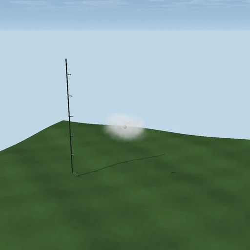
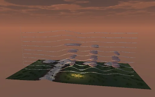
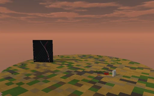
Watch a summer afternoon build a thunderstorm over the prairie: the sun heats the ground, the mixed layer deepens along the dry adiabat and eats into the cap above it, and the lifted parcel - dry to its condensation level, then saturated along the pseudo-adiabat - shows its CAPE and CIN on a sounding board beside the sky. Fair-weather cumulus sit at cloud base, about 125 m up for every kelvin of dew-point depression, until the thermals carry the parcel past its level of free convection; then the tower climbs at the plume’s speed, an entraining updraft well below the closed-form sqrt(2 CAPE), and spreads into an anvil at the equilibrium level. Its rain sets off a cold downdraft whose gust front chokes the cell. Strengthen the cap and the storm never comes; dry the air aloft and the outflow turns colder.
What happens
The 9:00 sounding: 24 °C at the ground, 6.5 K/km up to a 300 m capping inversion at 1.8 km that is 2.5 K warmer than the lapse rate would make it, 7 K/km above to a 12 km tropopause, isothermal above; 1000 hPa at the ground, hydrostatic pressure in closed form. A sensible heat flux of 400 W/m² at 13:00 (sunrise 6:00, sunset 20:00) heats a mixed layer that follows the dry adiabat g/cp from the surface temperature to where it meets the sounding; its heat content ρ·cp·∫(T − T_morning)dz equals the heat supplied. The surface parcel (dew point 17 °C) rises dry to its exact condensation level, then along the pseudo-adiabat with the Murphy–Koop vapour pressure, RK4 every 100 m; B = g·(Tp − Te)/Te gives LFC, EL, CAPE and CIN. A plume d(w²/2)/dz = B − g·f·q_c − 2ε·w²/2 starts with the convective velocity w* = (g·h·H/(ρ·cp·T))^(1/3); the storm breaks out when it carries the parcel past the LFC and above −10 °C at 1 m/s or more. The tower then rises at the plume’s speed, the anvil spreads at the EL by π·a²·w_EL over a 2 km depth (a = 2.5 km), the condensate flux ρ·w·q_c fills the cloud; ten minutes after the tower passes −10 °C the rain reaches the ground, the heating stops, and the cloud water drains as dW/dt = C − W/τ with τ = top/(8 m/s), half of it as rain; the cold outflow chokes the updraft one fall time later. A saturated downdraft from 3 km gives DCAPE, the cold pool and a gust front √(2·g′·500 m); lightning follows the Price–Rind rate of the cloud-top height.
Try this
Watch the cap hold through the early afternoon and the cumulus deepen; read CAPE, CIN and the cloud base against the 125 m/K rule; set entrainment to zero and compare the updraft with √(2 CAPE); strengthen the cap until the storm never comes; dry the air aloft and watch the outflow turn colder.
The model and its limits
Parcel theory with a one-dimensional plume and a slab mixed layer: no virtual-temperature correction, no ice, no wind shear, no resolved cloud dynamics and no electrical model - the tower, anvil, rain shaft and lightning are drawn from the parcel numbers, and the flash rate is the empirical Price–Rind law. One ordinary cell, choked by its own outflow; the mixed layer keeps its morning mixing ratio. Numbers belong to this idealized afternoon.
Equations used in the module
Equations
ρ·cp·∫(T − T_m) dz = ∫H dt,  T = T_s − (g/cp)·z below h
dT/dp = (R_d·T/p + L·r_s/(p − e_s))/(cp + L·∂r_s/∂T),  B = g·(T_p − T_e)/T_e
d(w²/2)/dz = B − g·f·q_c − 2ε·w²/2,  w_EL = √(w0² + 2·(CAPE − CIN)) at ε = f = 0
dW/dt = ρ_b·w_b·q_c − W/τ,  DCAPE = ∫ g·(T_e − T_d)/T_e dz,  c = √(2·g′·h)