Earth
Mountain building
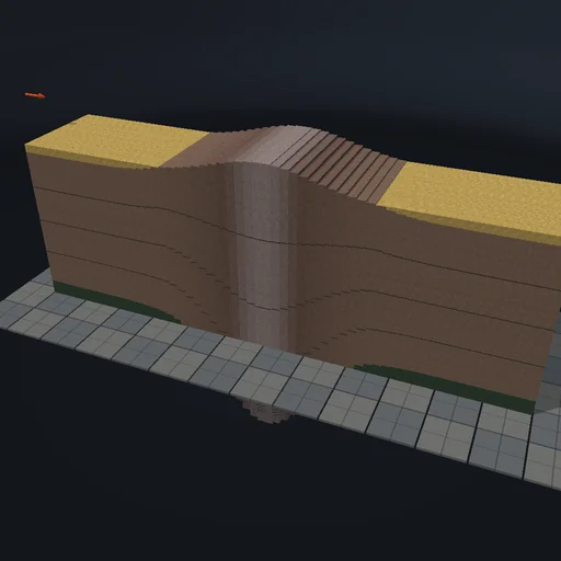
Push two continents together and watch the crust thicken, rise and grow a root under the range; switch erosion on and the summits lower while the eroded rock fills the basins on both sides, the sum of crust and sediment staying exactly what was there plus what was fed in. Compare fast and slow convergence, a wide and a narrow deformation zone, and lighter crust that floats higher.
What happens
A 600 km section of crust in 60 columns converges at a set rate: the crust fed in, v·h_in per Myr, is spread over a Gaussian deformation zone as thickening, so the crust’s area is conserved exactly. Each column floats by Airy isostasy - elevation (ρ_m − ρ_c)·(h − h_0)/ρ_m, root ρ_c/ρ_m of the thickening, sediment counted with its own density. Erosion takes K times the elevation per Myr off every column above sea level and lays it in the lowest column of its half, so crust plus sediment stays what was there plus what was fed. Explicit Euler in 0.01 Myr steps; one second of the experiment is one Myr.
Try this
Watch the range rise and its root deepen; turn erosion up and see the summits lower while the basins fill; stop the convergence and nothing moves.
The model and its limits
A prescribed deformation zone instead of fault mechanics, local Airy isostasy without flexure, erosion linear in elevation, sediment laid in one column per side. A teaching section, not a reconstruction of a range.
Equations used in the module
Equations
dh_i/dt = v·h_in·f_i/Σ f_j·Δx,  f = e^(−(x/W)²)
e = ((ρ_m − ρ_c)·(h − h_0) + (ρ_m − ρ_s)·s)/ρ_m
root = h + s − e − h_0
de/dt = −K·e  (e > 0)