Earth
River delta
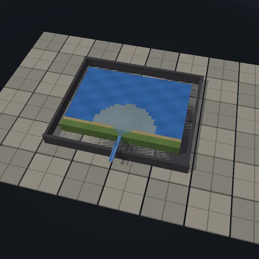
Send a river of 200 m³/s carrying a hundredth of a cubic metre of sand a second onto a shelf and watch a century of delta grow: the water spreads to every lower neighbour in proportion to slope, each cell of sea drops a share 1 - exp(-depth / 4 m) of what passes and rises until it stands above the sea with a gentle seaward slope, the shoreline advances and the river finds several mouths. Triple the sediment and the lobe sweeps across the whole shelf; deepen the shelf and the same sand builds less land; raise the sea a centimetre a year and the gain is smaller still. Sediment supplied equals deposited plus exported to rounding.
What happens
A delta on a grid of 32 by 24 cells of 100 m: the river enters at the bottom centre of a sloping coastal plain and its water and sediment are routed cell by cell in order of falling potential (the bed on land, the sea level less a fifth of the depth at sea, so flow spreads towards deeper water) to all lower neighbours in proportion to slope. Each cell deposits a share 1 − exp(−depth/λ) of what passes, at least two percent, up to a cap that falls gently away from the inlet so the plain keeps a seaward slope; what reaches the rim or a pit leaves. Synchronous bed update every 0.05 year; supplied equals deposited plus exported to rounding. One second of the experiment is one year.
Try this
Watch the lobe build out and the mouths split; triple the sediment, deepen the shelf, raise the sea and compare the land built after a century.
The model and its limits
Deterministic multi-direction routing without inertia, waves or tides, a depth-based deposition rule, no channel incision or avulsion dynamics. Land areas are those of this cellular rule.
Equations used in the module
Equations
η = z (z ≥ S),  η = S − r·(S − z) (z < S)
Q_ab = Q_a·w_ab/Σw,  w = (η_a − η_b)/d_ab
f = max(f_land, 1 − e^(−depth/λ)),  Δz = min(f·q, cap)/A
Q_s·t = V_deposited + V_exported