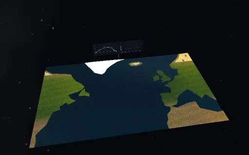
Earth
Seasonal monsoon
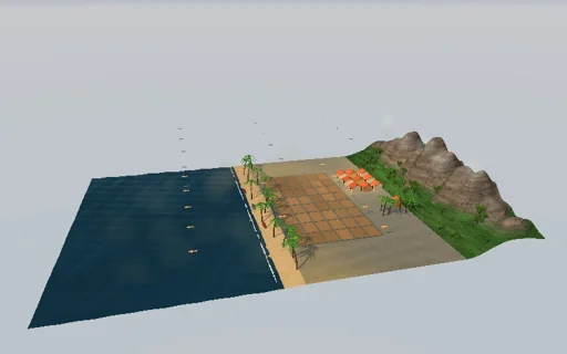
Follow a South-Asian coast through the year. The same sun heats the shallow land and the deep sea, but the land answers within days and the sea two months late, as the closed-form gain 1/sqrt(1+(ωτ)²) and lag atan(ωτ) say. Their contrast drives an overturning wind; onshore it brings the sea air’s moisture, and the rain’s latent heat strengthens the very circulation that brought it. So the monsoon does not grow gently: once the land’s forcing turns positive the rain jumps to a deluge within a week, dark clouds roll in from the sea and pile against the hills, the paddies flood and turn green; it holds on into the autumn until the forcing falls below the fold R_c = −M²/(4Dκ). Hold the season and the coast is bistable: a moist surge flips it wet, lowering the heating or the moisture past the closed-form threshold dries it for good. The moisture budget closes to round-off.
What happens
Two boxes under the same seasonal heating H = S1·cos(ω(t − t_p)), S1 = 85 W/m², peak on day 172, relaxing at B = 15 W/m²K to T_e = 27 °C: the land, 6 m of soil (C_L = 1.5×10^7 J/m²K, τ = 11.6 days) with an extra heating ΔQ = −76 W/m², and a 50 m ocean mixed layer (τ = 158 days) four times its area. The contrast x = T_L − T_O drives the drag-balanced wind U = κx, κ = gH_a τ_d/(T_0 L_x) = 1.41 m/s per K (H_a = 1 km, τ_d = 1 day, L_x = 2000 km). Onshore it imports the sea air’s moisture U·W_s/L_x (W_s = 55 kg/m²), offshore it exports the land’s; the land’s moisture W rains out in a day, P = W/τ_P, and releases L_v·P over the land; the overturning carries D|U|x (D = 12) from the warm box to the cold one; the sea pays the latent heat of what it supplies. Rain fills the soil and paddies, which drain in 30 days. With the sea held, the land balances on Dκx² − Mx − R = 0, M = L_vκW_s/L_x − B = 82 W/m²K: the monsoon switches on when R turns positive and exists down to R_c = −M²/(4Dκ) = −99 W/m². With the season held both boxes balance on (1+r)Dκx² − ((1+r)L_vκW_s/L_x − B)x − ΔQ = 0: dry, unstable and wet roots between ΔQ_c = −134 W/m² and zero. The hills split the same rain (1 + h/h0)/(2 + h/h0) to the windward side, h0 = 1 km. RK4 at 3 hours with the ledgers integrated at the same weights; the year starts on 1 March after a two-year spin-up.
Try this
Watch the dry season’s offshore wind turn round and the rain jump in a week; compare the onset with the land forcing crossing zero and the withdrawal with R_c; switch off the latent heat or the circulation; deepen the sea or the soil; hold the season and flip it with a moist surge, then lower the land bias or the moisture past the threshold and back.
The model and its limits
Two boxes, one land and one sea, with a fixed seasonal heating and a fixed time of day: no rotation, no moving rain belt, no land evaporation or recycling, and the sea air’s moisture is a setting rather than following the sea temperature. The wind is the steady drag balance of the contrast. The fold R_c is that of the land balance with the sea held, so the seasonal withdrawal comes some weeks after the forcing falls below it; the held-season roots are exact. The hills only share the same rain between the windward plain and the lee. The scene is not to scale; clouds, dust and lightning are decoration driven by the rain rate.
Equations used in the module
Equations
C_L·dT_L/dt = H(t) + ΔQ − B·(T_L − T_e) − D·|U|·x + L_v·P,  H = S1·cos(ω·(t − t_p)),  x = T_L − T_O
C_O·dT_O/dt = H(t) − B·(T_O − T_e) + r·(D·|U|·x − L_v·F),  U = κ·x,  κ = g·H_a·τ_d/(T_0·L_x)
dW/dt = F − W/τ_P,  F = U·W_s/L_x (onshore) or U·W/L_x (offshore);  imported = rain + exported + ΔW
gain 1/√(1 + (ωτ)²), lag atan(ωτ);  R_c = −M²/(4·D·κ),  M = L_v·κ·W_s/L_x − B;  held: (1+r)·D·κ·x² − ((1+r)·L_v·κ·W_s/L_x − B)·x − ΔQ = 0